Autumn in the North Cemetery.

Sixty miles west of Boston, Massachusetts there is the small New England town of Sturbridge. Located at the junction of I-90 (The Mass Pike), and I-84 it has become known as the "Crossroads of New England". The town was first settled over 300 years ago, and like other small New England towns it has grown just enough over the years to be in a difficult place today. How do we embrace the future without forgetting how we got to our present? How do we attract the right kind of growth, and maintain who we are? And, what about our culture out here in Central Massachusetts?


These pages will cause one to think about how to protect what we have, our future direction, and how to move on in the very best way.


Those thoughts, and other ramblings, will hopefully inspire more thought, conversation, action, and occasionally a smile...

...seems to be working so far

Monday, December 3, 2007

Damn, if it Don't Look the Same, Marge!

Where is it?

The building in this old photo, taken around 1900-1910, looks very much as it does today.

Can you locate it? Do you know who owns it? Can you read what the signs say on the front of building? If you can, let me know. I can't read them for the life of me.

"Just goes to show ya, Burt, the moah things change 'round here, the moah things stay the same."

Sunday, December 2, 2007

Take Your Head for a Sunday Drive

We like to wander. On a Saturday, or Sunday we like to point the truck in a direction we haven't been in awhile, find a road we haven't traveled, and increase our carbon footprint a little.

I grew up in Medfield. It was a small town. Lots of meadows, swamps, streams, and woods to wander as a kid. I have always remembered those times exploring the woods, following a stream, or just watching the ducks in some remote pond deep in the woods. Those were peaceful times.

As I grew, and moved away, I lost that connection with the woods, and meadows. I lost that wonderful feeling I used to get when I found an unknown old country road, and explored it till its end. It would be cliche to say that "life got in the way", but the truth is I lost my way.

That was until I moved to Sturbridge.

Now, I am home again.

If you have lived in the area all your life, then you know what is out there beyond the next curve, or over the stonewall. You know the unspoiled beauty we have in our area. Much of it is how it was 150 years ago.

Or, maybe, you don't.

I know how it is to become a slave to routine, and not venture far from your front stoop. Been there. But, if you take an hour and a half every week or so, and "go on an explore", not only will you find things you have never seen in your own backyard, but your frame of mind will be changed. You'll be more at ease. Believe me, you will whether you want it or not. Wandering the back roads of Central Mass is good for the soul, and the head.

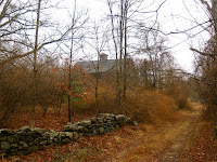
The photo on the right was taken just off the road on Route 198. The barn was abandoned, but the scene that day wasn't. I stopped the truck, and stared off into the field. Eventually I took this photo.

There is so much to see in our here. Places we've never been. Quiet, peaceful places all around us. Its just taking the time to find them. Once we do discover them for the first time there is a very unique feeling that comes over us. Like finding $20.00 in a pair of old jeans, or a family photograph long thought lost. A feeling of recovery.

The view will change depending on time of day you go, the season, the weather, and your companion. One person will see something completely different than another. The photo on the right was taken along the Grand Trunk Trail just west of the Westville Lake. It was taken in the early morning as the mist was beginning to lift. It looked totally different a few weeks before.
I would never have found it if I hadn't pushed myself out of bed, and pointed the truck towards Westville, and gone for a walk with Mary.

We all have a lot going on in our lives. Schedules. Responsibilities. But that is life, not living.

This is where the free, unasked for advice comes in. If you want to loose the rough week you just had, forget the schedules, the issues, the drama in your life and reconnect with someone special, then do this: this weekend get out of bed early, load the car with special someones, and point the car away from your house in a direction you haven't gone in a long time, then drive. After 15 or 20 minutes take the first little road you see that you don't know, and follow it. Once you are sure you haven't a clue where you are, look around you and find that place to take a walk, or stare off onto a lake. After awhile, all those weights from the week fall to the ground. Your pace picks up, you enjoy the smells, the light coming through the trees, and the mist still in the air. Look around at those with you. If they are still with you, and your teenager is not texting someone, then they are feeling the weights fall, too.

If they are smiling, its all the better.


Top Photo: Stream flowing into the Ware River in Hardwick, MA

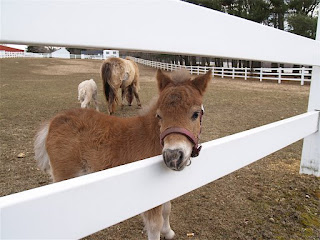
Bottom: Miniature horses at Sawmill River Farms West Brookfield http://www.srfminis.com/

I Live in an Unofficial Thickly Settled Suggestible Speed Limit Area

A little over one year ago I met with the Town of Sturbridge Traffic and Safety Committee, chaired by now Chief of Police, Tom Ford. At the meeting I expressed my concern regarding the fast speed of the cars traveling on Route 148, Brookfield Road, in Fiskdale.

Now, I wasn't concerned about the speed they traveled on the entire road, the rest of the road seems to be marked just fine, and is enforceable. I was concerned just about the portion of the road that starts at Route 20 and ends around Champeaux Road. About a mile or so.


To be more exact, the area in front of my house.

Now, don't misunderstand me, I am not just concerned about traffic safety in front of my house, it just so happens that I happen to live in a "Traffic Never-never land".

Just my luck. Now, let me explain.

Near the beginning of Route 148 , at Route 20, there is a yellow SPEED LIMIT sign. "35 MPH" it reads. About 200 feet further north there is another sign reading "45 MPH". It's where that second sign is that is the problem. That is where the houses become thickly settled. Official Thickly Settled areas in Massachusetts have a Speed Limit of 30 MPH, but the houses have to be 200 feet apart, or closer. Now, to look at the area you'd probably say, "What a nice area. A nice thickly settled area." But, I have learned that it takes more than ones eyes to make an area thick.

For that first mile, or so, the "Thickly Settled" look of the houses is not official. Oh, sure, they sure look like they are, but I learned at the meeting, from Tom Ford, that the matter would need to researched in the Mass Highway records to determine if they actually are settled thickly. I asked whether measuring the distance between the houses is something we could do. "No", I was told, "Not yet. I'll research the records first.".

Something else I learned that day. Those yellow speed limit signs are not enforceable. Nope. The white speed limit signs are enforceable, yellow ones are merely a suggestion, a recommendation. They are a recommended speed for the area. A specific formula is usually followed to determine this. A formula privy to the road engineers based on curves, road width, elevations, and the like. The signs can also be placed entirely at random. Judging form their location, and distance apart, I believe that they were planted where the dirt was the softest.

So, not only is this thickly settled zone actually thickly settled, but not officially, and it is also only a Suggestible Speed Area.

I was in a worse place than when I came into the meeting.

Well, after learning a lot at the meeting from folks that know a lot more than I did, I was told that they would look into the Thickly Settled thing, and in the meantime, they would place a cruiser, now and again, off the road to slow the traffic. They also offered to place that mobile radar detector sign on the road to slow the traffic.

I did have a suggestion, though. Just relocate the signs. Keep the 35 MPH sign where it was, near the start of 148, and take the 45 MPH sign and move it north to around Champeaux Road.


Simple. We just extended the 35 MPH zone to a mile instead of 200 feet. No need to measure, or research the area for being Thickly Settled since the speed limit would be 35 MPH, not 30MPH. 35 MPH if fine. Just a dig a new hole in the ground a mile north for the sign post, and Voila!

Well, that idea didn't fly. Not complex enough. I was at a committee meeting. One thing I have learned over time is that committees are committees.


'Nuff said about that.


Now, it's been 14 months. We've seen the cruiser parked at the video store parking lot now and again. Its presence does have a nice way of slowing folks down, but I haven't seen the radar sign board, and I haven't seen anyone out there with tape measures either. No follow up phone calls asking me how things are, or "How's the average speed of the vehicles in front of your house today?". Nope, not even a card.

What I have seen is cars, lots of them, at last count, over 7500 per day (I didn't count them, Mass Highway did), and most of those cars are driving fine, taking the "suggestion" to heart, but still too fast. But, there are the other ones, the very fast ones. I'd say about 1 in 10 cars are one of those.

And here I wait.

I have a way of doing things. I expressed a concern. Listened to the experts. Took their advise and agreed to their plan. And waited.

I'm still waiting.


Now, I fully understand that stuff just gets in the way. Priorities have to be set. And, I also understand that folks just plain forget. Boy, do I understand that. If it wasn't for the great signs from Boston to Sturbridge I'd never find my way home each day. I followed up one year after that meeting with a member of the committee, and he forwarded my follow-up questions on to the committee chair.


It's been three months, and I'm still waiting.


I tolerate a lot, but if I respect your position and knowledge enough to seek out your advise, and a resolution to a problem, then don't ignore me. Follow through.

Someday there will be a very bad accident on this stretch of road. Probably not between two cars, or a car and a tree. It will be between a car and a pedestrian. There are no sidewalks here, yet the road is used by walkers, mothers and fathers with strollers, kid on bicycles, and folks scooting across the roadway to their mailboxes. And all for the sake of a tape measure, and a post hole digger.

I am not going to beat this to death. The experts, and the Chief have heard my concerns, and they have the power to act, and make this stretch of road safer. It's in their hands now. After all, they are the Traffic Safety Committee. I hope their lack of action is not their answer. No, I'm not going to beat this to death at all. Someday, a Buick doing 55 MPH is going to do that. And, that day won't be a time for , "I told you so.".

They'll know, in fact, they already do.


For more information regarding speed limit laws in the Commonwealth go to:
http://www.motorists.org/ma/ma2.html

Saturday, December 1, 2007

Where is it? No, Really, Where is it? I Haven't a Clue.


Yesterday I posted an old photograph and asked the readers to identify the building. This morning I found that it had been identified by "Stur" as the building that houses the Handmaiden, and the Copper Stallion Restaurant. Wow. That was fast, and correct, too. Maybe just a bit too fast. So, today I am posting another old photograph. As you can see on the postcard it is labeled "East Main St. Sturbridge, Mass.", but where exactly is it? This photograph has puzzled me for some time, but I have a good idea where it possibly could be. Any help in ID'ing the location would be great!

About That Dump We Bought...

On a recent post I wrote of the recently acquired land south of the Quinebaug River that stretches from Stallion Hill Road to Holland Road. In it I referred to there being a dump on the land, and my concern for it's clean up now that we own it. Well, today I am posting some photos of the land. Now, please understand, not all the land is a "dump", but the land that is tainted will certainly have to be addressed. The cost of such a remediation will be a lot, but not impossible. The Town made a very good decision to purchase the tract. It is beautiful.

Old appliances dumped on the road coming in from Stallion Hill Road.


TOP: Glass and stoneware shards litter the ground. SECOND: Countless old items poke through the leaves.
THIRD: Tin and porcelain items on the surface. BOTTOM: Abandoned equipment.